
KOLKATA FERRY SYSTEM URBAN ANALYSIS
India has one of the largest population density in the world. As the third biggest city in India, Kolkata has lots of transportation problems such as inefficient street planning and lack urban mobility. Our urban ferry system will estimably reduce the traffic-heavy situation in Kolkata. It deploys programmed infrastructure on the Ganges, policy recommendations, guidelines, and urban infrastructure to relieve on-ground traffic.
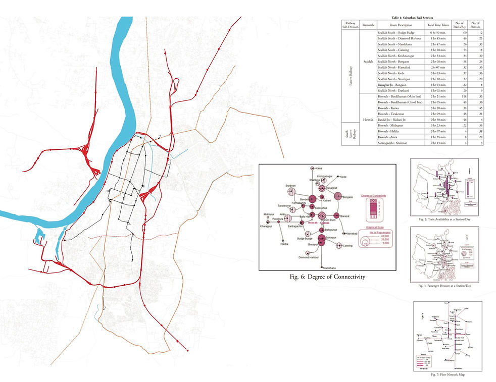
Before we propose a fully comprehensive solution, we need to prioritize, build smart, and recognize where best to focus our resources. Our approach is first to analyze regional and urban infrastructure including water, different types transportation corridor, existing freight corridor, population, size of land holdings and more. In doing so, we are better positioned to identify the opportunities to design a ferry system.
Location
Kolkata, India
Involvement
Computational Visualization, Data Analytics, GIS,
Urban Design
Advisor
Prof. Arindam Dutta, MIT School of Architecture
Team
Zhiwen Qiu, Austin Wade, Milap Dixit
Year
2016
My Role
I worked with prof. Arindam Dutta in Infrastructure Architecture Lab at MIT School of Architecture and other grad students. I participated in all research process on both regional and neighboring cities near Kolkata, including mapping layers of existing traffic nodes, water systems and population density with urban data visualization and modeling tools such as Rhino (grasshopper) and GIS.
Kolkata


Regional


Varanasi


